
Discover Chelsea, MA: The Neighborhoods and Squares That Make It Home |
From Bellingham Square to Prattville and Admiral’s Hill, explore the places, history, and everyday connections that give Chelsea its character. |
You can pass through Chelsea on the Tobin Bridge and miss much of what makes the city worth knowing. At street level, there are squares built around civic life, former factories with new uses, neighborhood parks, and a waterfront that connects the city’s past with its present.
For people moving to Chelsea, Massachusetts, learning these places can make an apartment search more useful. For longtime residents, it can offer a reason to take a different walk, visit a museum, or spend an afternoon beyond the usual errands.
Start with the names. Bellingham Square and Chelsea Square are different places. The Box District’s name comes from manufacturing. Prattville has a history tied to the Pratt family, while Admiral’s Hill brings the waterfront into the picture.
These names are useful starting points, rather than a complete set of precise boundaries. A square, a historic district, and a neighborhood can describe different things. This guide focuses on recognizable places and what you can discover around them.
Bellingham Square: Start with Chelsea’s civic center
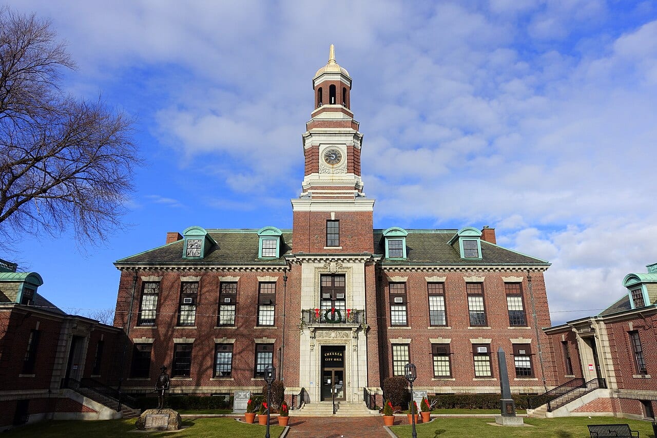
If you are learning your way around Chelsea, Bellingham Square is a useful first stop. City Hall at 500 Broadway gives you an unmistakable landmark, with the square sitting at the meeting of Broadway and Washington Avenue.
Its appearance tells a story about rebuilding. After the devastating 1908 fire, the city placed its new City Hall here. Designed by Peabody and Stearns, the building recalled Philadelphia’s Independence Hall and helped establish the area as Chelsea’s renewed civic and commercial center.
Look above the storefronts to appreciate the older buildings, then look closer. Discover Chelsea’s public art tour explains the Civil War memorial and Mags Harries’s small bronze works associated with the square. The guide notes that some bronze pieces have been lost over time.
For a first visit, use City Hall as your reference point and explore the surrounding blocks. Look for a place to get lunch, locate a bus stop, or follow a detail that catches your eye. You can learn a lot without making the walk a formal tour.
Chelsea Square: Public art, food, and a night at the theater
Chelsea Square offers another starting point, around Broadway and Winnisimmet Street. The Stebbins Fountain, built in 1897, anchors a small public space surrounded by historic buildings.
|
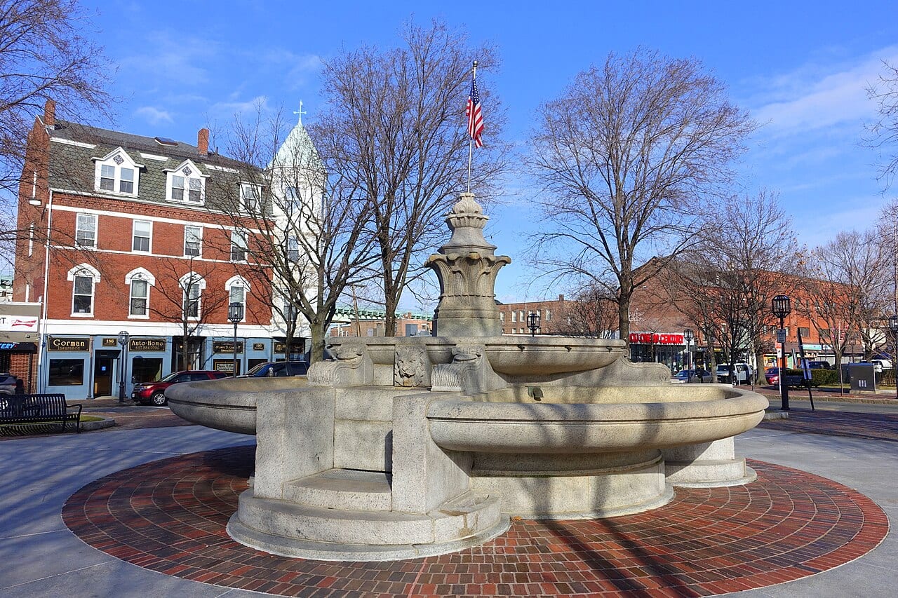 Stebbins Fountain in Chelsea Square, photographed December 30, 2018. Photo: Daderot / Wikimedia Commons (CC0 1.0). |
There is good reason to slow down here. The city’s public art guide identifies bronze crabs embedded in the park’s brick paving and Penelope Jencks’s Chelsea Conversation, a group of life-size figures installed in 1978. These are details you might overlook while heading somewhere else.
The square also makes it possible to build an outing around dinner and a performance. Apollinaire Theatre Company is based at Chelsea Theatre Works, 189 Winnisimmet Street. Check its current season before planning an evening.
For a meal before or after exploring, Discover Chelsea groups nearby dining choices in its Chelsea Square guide. Check the restaurant’s own hours when making plans.
You can keep the visit simple: look for the public art, choose somewhere to eat, and leave a performance for another evening. The square gives you several reasons to come back.
The Box District: Chelsea’s industrial past in a new setting
The Box District has a name with a literal explanation. Box-making businesses once operated here, and their history remains part of the neighborhood’s identity.
Discover Chelsea’s legacy business tour highlights Standard Box Co. at 44 Gerrish Avenue. The company moved to Gerrish Avenue in 1921. Its story connects everyday packaging—boxes for shoes, food, and other products—to the city’s manufacturing economy.
The guide also points to the old painted Standard Box sign and the property’s reuse for housing. That makes the district a useful place to think about how Chelsea changes: an industrial name can survive even as buildings take on different purposes.
The Silver Line gives the area another recognizable reference point. Box District station is at Gerrish Avenue and Highland Street.
Try pairing a look at the old industrial site with the tour’s historic images. The old factory name helps explain a part of Chelsea that a modern transit map alone cannot.
Admiral’s Hill: Make time for the waterfront
Admiral’s Hill is a natural place to begin if your idea of getting to know Chelsea includes time outside. The area’s history includes the former Chelsea Naval Hospital, while nearby Mary O’Malley State Park puts the river and Boston skyline in view.
The state’s Mary O’Malley State Park guide lists walking paths, a playground, tennis courts, and a picnic area. It also identifies paved paths as an accessibility feature. The city’s parks guide notes the mix of flatter waterfront paths and hills around Admiral’s Hill.
There is no need to turn the visit into a workout. Bring something to eat, make room for playground time, or simply plan a walk with a friend. The skyline and Tobin Bridge give you something to look toward while you take a break.
If hills or walking distance are a concern, check your route and entrance before setting out. The waterfront paths and surrounding hillside offer different kinds of outings; choose the one that suits your group.
Prattville: Follow Washington Avenue into the neighborhood’s history
Prattville offers a different way into Chelsea’s story, with Washington Avenue serving as a useful thread through its landmarks.
The Prattville walking tour, developed by resident researcher Lee Farrington, traces the influence of the Pratt family over generations. Its stops connect homes, parks, and a former school to the neighborhood’s development.
One especially recognizable building is the former Prattville School at 441 Washington Avenue. Built in 1897, it closed as a school in 1997 and was converted into loft condominiums in 1999. It is another example of an older Chelsea building finding a new role.
The tour also includes Washington Park and Voke Park. At Washington Park, it describes a stone from the old Pratt Mansion incorporated into the Nichols Street wall, commemorating George Washington’s connection to the site.
You can use the online guide to plan a short walk rather than cover every stop. Keep in mind that some landmarks are private homes or former sites. Enjoy them from public areas and use the historic photographs to help imagine what has changed.
Cary Square: A place to explore Jewish Chelsea
Cary Square adds another important chapter through Temple Emmanuel and the Jewish Chelsea Museum at 60 Tudor Street.
The building’s history stretches across congregations. Its nineteenth-century Baptist origins were followed by Methodist use and, later, a Jewish congregation. Today, the museum offers a way to learn about the people and institutions that helped shape Chelsea.
Start online with the museum’s neighborhood voices, photographs, interviews, and stories of local businesses and families. You may recognize a street name or discover a piece of family history that changes how you see a familiar block.
There is one practical detail to know before going: museum visits are by appointment only, arranged through its website’s submission form.
If you have lived in Chelsea for years, this could be a rewarding place to bring a visiting relative or start a conversation about your own memories. For newcomers, it offers a way to meet the city through the people who have called it home.
Beyond the squares: Learn the other names on the map
Chelsea’s neighborhood story extends beyond these stops. The city’s Chelsea ¡Pa’Lante! planning materials also use names including Addison Orange, Shurtleff Bellingham, Mill Hill, and Soldier’s Home, alongside Prattville and Admiral’s Hill.
The planning maps place Mill Hill toward the city’s eastern side, Shurtleff Bellingham east of the city center, and Addison Orange farther north. These broader areas help connect the familiar squares and landmarks to the rest of Chelsea.
Treat the names as a way to get your bearings, then look for the places within them. A park, a corner store, or a familiar cross street may be a more useful reference than a broad label.
This is a starting guide, not an inventory of every neighborhood or local name. Ask neighbors what they call their area and which places they would show someone new to Chelsea.
Get to know Chelsea through your own routine
There is no single neighborhood description that can answer every household’s questions. A park may matter most to one person; a particular bus connection, place of worship, or nearby relative may matter more to another.
The Silver Line SL3 has four stops in Chelsea: Chelsea, Bellingham Square, Box District, and Eastern Avenue. Use those locations to orient yourself, and consult the MBTA’s SL3 route page for current schedules and service information.
If you are moving, visit at the times you would normally leave home and return. Walk the route, notice crossings and slopes, and find out how the apartment’s parking arrangements work. Compare specific addresses rather than assume every block within a named area offers the same experience.
Pair that visit with our cost-of-living guide to Chelsea, which explains how housing, transportation, utilities, and everyday expenses fit together.
If you already live here, choose one place in this guide you have been meaning to explore. Look for the bronze crabs, follow a piece of Prattville’s history, or arrange a museum visit. There is plenty of Chelsea to discover beyond the route you already know. |
0 Comments
Join the conversation
Be the first to comment
Share your thoughts above.